|
|
 |
|
|
GWR Route: North Warwickshire Line
GWR Route: Banbury to Wolverhampton
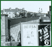
Bordesley Station: gwrbg2704
 |
The 1889 survey shows the waiting room as approximately 35
feet by 25 feet and appears to be above the access tunnel thus on the first
floor behind the covered way and partly above the access tunnel (see image 'gwrbg2706' for a part view of the station entrance).
It is logical that the Station Master's office probably faced the street
beneath the covered way so there must have been a staircase from the street
level. The waiting room backed onto the 470 foot long Down platform SW boundary
and it may have had a direct connection as well as via the staircase up from
the tunnel beneath. This was via a 103 foot x 21.5 foot covered structure at
platform level to which the access staircase entered. The Up platform was 460
foot long and had a separate waiting room 32 foot x 9 foot part which was
divided off into 7 foot x 9 foot area which may have been a toilet/urinal. At
Coventry Road bridge terminated the Down platform at the SE end was was one of
Brunel's Balloon Topped Wrought Iron girder bridges. The Outer sections being
20' wide by 71 foot long and the middle girder 28" wide by 71.5 foot long. By
the time of the OS survey the broad gauge lines had been lifted but the common
Down line remained aligned with the bridge though the Up line appears to have
been shifted slightly to share the old Broad outer metal. To see a plan of the
second station see 'gwrbg2705'.
The above schematic was derived from clips of the 1889 OS
First edition, 1950 1:1250 OS edition and the early 1900s Rail 270/30 property
plan being overlaid and adjusted via Autocad to a common scale. (1:500).
Graham Laucht
 back back
|
|
|