|
|
London North Western
Railway:
Midland
Railway:
Stratford
Midland Junction Railway
|
|
LMS Route: Rugby to Wolverhampton
LMS Route: Nuneaton to
Leamington
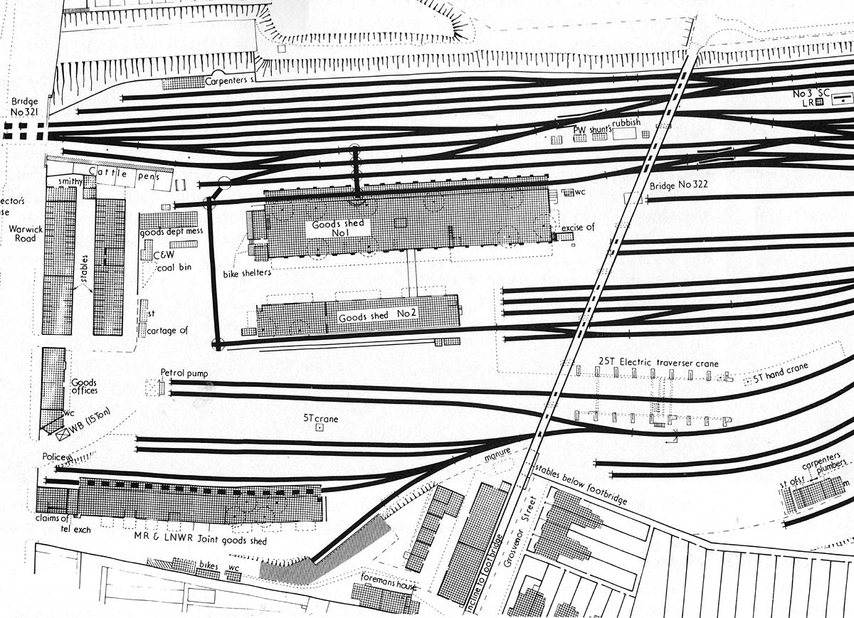
Coventry Station: lnwrcov2769a
Part of the Ordnance Survey map showing Coventry Goods yard and
the two LNWR sheds and the joint MR/LNWR shed. Both incoming and out going
goods were collected or delivered to local customers via horse drawn vehicles.
The horses were primarily stabled on the ground floor of the two multi-storey
buildings running parallel with Warwick Road with one building fronting on to
the roadway. Other stables could be found adjacent to Grosvenor Road beneath
the Spencer Park footbridge. Cattle pens were provided adjacent to Warwick Road
bridge next to the blacksmith's workshop. The offices to the goods yard were
located next to the Weigh Bridge itself sited by the entrance to the goods
yard.
 back back
|