|
|
 |
|
|
GWR Route: Banbury to Wolverhampton
Leamington Spa: gwrls2040
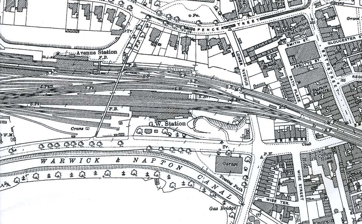 |
A 1925 Map showing the proximity of the GWR and LNWR stations
and the trackwork linking the two companies. The approach to the station
appears to be the same as when the station was first opened some 75 years
earlier albeit with the two road entrances being more defined in this view when
compared with image 'gwrls2106'. The goods shed has
now been relocated away from the station allowing for a bay platform to be
built at the Birmingham end of the down platform. The bay at the Birmingham end
of the up platform is also evident as is the pedestrian bridge that span both
the GWR and LNWR lines. The pedestrian tunnel beneath the GWR lines which
provided access to the up platform has by now been extended beneath the LNWR
lines which would ultimately allow the pedestrian bridge to be dismantled. The
6 ton fixed crane seen near to the Old Warwick Road end of the passenger bridge
was one of two at the yard used to unload coal for the nearby gasworks. Both
were capable of being fitted with 'grabs' to off load the coal from the wagons.
By 1940 some 40,000 tons of coal were being handled each year with the figure
rising in line with the growth of the town. The discovery of North Sea Gas
meant that this trade was lost when the gas works closed in 1964.
 back back
|
|
|