·  LMS  ·  GWR  ·  LNER  ·  Misc  ·  Stations  ·  What's New  ·  Video  ·  Guestbook  ·  About

Napton & Stockton Station

LMS Route: Leamington to Weedon

Napton & Stockton was located between Southam & Long Itchington station and Flecknoe station. Despite the village's name being used first in the station's name Napton on the Hill was some two miles away whilst Stockton was relatively closer. It was built with a passing loop to serve a second platform, a small goods yard and a small goods shed. A road bridge which carried Stockton Road over the railway was used to connect the two platforms with each platform being connected by steps leading down from the road. In Geoffrey Kingscott book Lost Railways of Warwickshire he claims the 'second platform and the passing loop were done away with'. As can be 
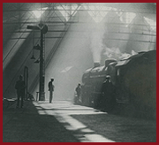
seen by viewing image 'lnwrn&s1755' which shows Ivatt 2MT 2-6-2T No 41218 at the rear of the two-coach push-pull train forming the last passenger service calling at the station, this is in fact an error. I suspect Geoffrey confused Napton & Stockton station with Southam & Long Itchington station where a platform was taken out.

The station opened on 1st August 1895 and remained open until it closed to passenger traffic on 15th September 1958 with its goods service being withdrawn on 2nd December 1963. As at Flecknoe, the station was constructed of timber throughout. The two platforms, buildings and passenger steps that led down to each platform from either side of the bridge. The style of building, long and narrow was very similar to that erected at Flecknoe. The up line's facilities included a Gentlemen's urinal, a ladies waiting room with internal toilet, a general waiting room and a porter's office. On the down line, the facilities were: a Gentlemen's urinal, a ladies waiting room with internal toilet, a general waiting room, stationmaster's office and a small signal box. The goods yard was located on the other side of the road bridge with a single siding. Adjacent to the loading stage (also noted on the 1904 OS map as containing cattle pens) was a weighbridge (weighing machine) and weighbridge office. These would be used to weigh vehicles arriving and departing from the yard when delivering bulk items. This facilities was open to the public at large and not restricted to clients of the railway company. The 1938 Railway Clearing House Official Hand-Book of Stations confirms that Napton & Stockton station offered facilities for the handling of passengers, goods, livestock and horses. The Hand-Book also noted the sidings Nelson's Lime & Cement Works being close by. No craneage facilities were available therefore large loads would have to be handled either elsewhere or by bringing in a rail mounted crane.

Looking towards Southam & Long Itchington as a local train passes the stations's up home signal
Ref: lnwrn&s2793
J Alsop
Looking towards Southam & Long Itchington as a local train passes the stations's up home signal
Close up showing the point rodding which ran from the up platform and across to the down platform
Ref: lnwrn&s2793a
J Alsop
Close up showing the point rodding which ran from the up platform and across to the down platform
Close up of Napton & Stockton station's down platform showing the steps down from the road and access to the platform
Ref: lnwrn&s2793b
J Alsop
Close up showing the up platform with the signal cabin nearest the camera and the toilets furthest away
Looking towards Southam & Long Itchington station from the down side of Stockton Road bridge
Ref: lnwrflek2792
Postcard
Looking towards Southam & Long Itchington station from the down side of Stockton Road bridge
Close up showing the down buildings which accommodated the passenger waiting rooms and toilets
Ref: lnwrflek2792a
Postcard
Close up showing the down buildings which accommodated the passenger waiting rooms and toilets

Close up showing the up platform buildings with a number of station staff posed for the camera
Ref: lnwrflek2792b
Postcard
Close up showing the up platform buildings with a number of station staff posed for the camera
Close up showing Napton & Stockton station's up platform with the steps coming down from the road to access to the platform
Ref: lnwrn&s1318b
Postcard
Close up of Napton & Stockton station's up platform with the steps coming down from the road to access to the platform
Looking towards Weeden with the main passenger building on the up line on the left and the down platform on the right
Ref: lnwrn&s1318
Postcard
Looking towards Weeden with the main passenger building on the up line on the left and the down platform on the right
Close up of Napton & Stockton station's down platform showing the steps down from the road and access to the platform
Ref: lnwrn&s1318a
Postcard
Close up of the station's down platform showing the steps down from the road and access to the platform
View of the up platform and main station single-storey building accommodating the booking office and passenger facilities
Ref: lnwrflek1324
Postcard
The up platform and main station single-storey building accommodating the booking office and passenger facilities

Close up of the up platform with the steps to the road bridge on the left and Stockton Mill goods yard on the right through the bridge
Ref: lnwrflek1324a
Lens of Sutton
Close up showing the steps to the road bridge on the left and Stockton Mill goods yard on the right through the arch
Close up showing part of the up platform with the waiting room located in the centre and toilets on the left
Ref: lnwrflek1324b
Lens of Sutton
Close up showing part of the up platform with the waiting room located in the centre and toilets on the left
Looking along Napton & Stockton's up platform as the station porter passes over the staff for the next section of line
Ref: lnwrn&s1319
Lens of Sutton
Looking along the station's up platform as the station porter passes over the staff for the next section of line
Looking towards Marton Junction from the down platform with the up platform on the right
Ref: lnwrn&s4382
LNWR Society
Looking towards Marton Junction from the down platform with the up platform on the right
Close up showing the building accommodates a small office at the far end accessed from the waiting room
Ref: lnwrn&s4382a
LNWR Society
Close up showing the building accommodates a small office at the far end accessed from the waiting room

Locomotives seen at or near Napton & Stockton station

Looking towards Weeden showing an unidentified LNWR 0-6-0 locomotive at the head of one of the first trains to traverse the single line route
Ref: lnwrn&s1758
WoW
Looking towards Weeden as an unidentified LNWR 0-6-0 locomotive heads one of the first trains to over the route
British Railways built Ivatt 2MT 2-6-2T No 41218 is seen at the rear of a two-coach push-pull train on the last Weeden to Warwick (Milverton) service
Ref: lnwrn&s1755
WoW
BR built 2MT 2-6-2T No 41218 is seen at the rear of a push-pull train on the last Weeden to Warwick service
Ex-LMS 2-6-2T 4P No 42566 is seen at the head of a train arriving at the station from Long Itchington
Ref: lnwrn&s4384
LNWR Society
Ex-LMS 2-6-2T 4P No 42566 is seen at the head of a train arriving at the station from Long Itchington
Ex-LMS 4-6-0 5MT No 44833 is seen at the head of a RCTS Grafton Railtour east of Napton & Stockton station after the line had closed to passenger services
Ref: lnwrn&s1760
M Mensing
Ex-LMS 4-6-0 5MT No 44833 heads a RCTS Railtour east of the station after closure of the line to passenger services

Ordnance Survey Maps of Napton & Stockton station and adjacent Lime & Cement Works

A LNWR One inch to Two-Chains Map of the approaches to Stockton Lime and Cement Works owned by Charles Nelson and Sons
Ref: lnwrn&s4391
LNWR Society
A LNWR 2-Chains Map of the approaches to Stockton Lime and Cement Works owned by Charles Nelson and Sons
A LNWR One inch to Two-Chains Map of the Stockton Lime and Cement Works owned by Charles Nelson and Sons
Ref: lnwrn&s4389
LNWR Society
A LNWR Two-Chains Map of the Stockton Lime and Cement Works owned by Charles Nelson and Sons
A LNWR One inch to Two-Chains Map of the Blue Lias Lime and Cement Works owned by Greaves, Brill and Larkin
Ref: lnwrn&s4388
LNWR Society
A LNWR Two-Chains Map of the Blue Lias Lime and Cement Works owned by Greaves, Brill and Larkin
A LNWR One inch to Two-Chains Map of Napton & Stockton station and its single line goods siding
Ref: lnwrn&s4392
LNWR Society
A LNWR One inch to Two-Chains Map of Napton & Stockton station and its single line goods siding
A LNWR One inch to Two-Chains Map of Napton & Stockton station showing the up line's facilities were, from left to right, a Gentlemen's urinal, a ladies waiting room with internal toilet, a general waiting room and a porter's office
Ref: lnwrn&s4387
LNWR Society
A LNWR One inch to Two Chains Map of the station of the up line's facilities: urinal, waiting rooms and office

A 1904 25 inch to the Mile Ordnance Survey Map of Stockton Lime & Cement Works and Napton & Stockton station
Ref: lnwrn&s4385
National Library of Scotland
A 1904 25 inch to the Mile OS Map of Stockton Lime & Cement Works and Napton & Stockton station
A 1904 25 inch to the Mile Ordnance Survey Map of both the Blue Lias' Lime and Stockton's Lime & Cement Works and Napton & Stockton station
Ref: lnwrn&s4386
National Library of Scotland
A 1904 25 inch to the Mile OS Map of the station, the Blue Lias' and Stockton's Lime & Cement Works
A 1904 25 inch to the Mile Ordnance Survey Map of both the Blue Lias' Lime and Stockton's Lime & Cement Works and Napton & Stockton station
Ref: lnwrn&s4383
National Library of Scotland
A 1904 25 inch to the Mile OS Map of the station showing the railway houses next to the goods yard