|
|
London North Western
Railway:
Midland
Railway:
Stratford
Midland Junction Railway
|
|
LMS Route: Rugby to Wolverhampton
Marston Green Station: lnwrmg4482
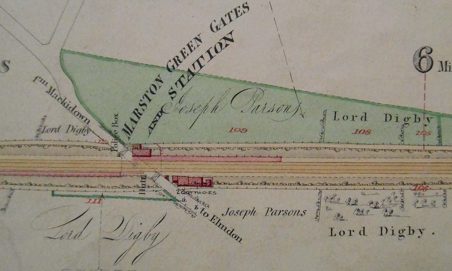 |
An updated version of an 1841 map of Marston Green Gates and
Station showing a 'Police Box' and two railway cottages. The staggered platform
configuration was to be found at many locations along the line to Coventry.
Marston Green, Berkswell and Tile Hill stations being other such stations. The
concept was that the short train could pass through the gates and stop clear of
the road thereby reducing to a minimum the delay to local road traffic. Before
block working protected trains en route it was the practice to work on a time
interval basis which meant the crossing could be closed for an indeterminate
amount of time if it was running late. There are many instances where such
practices caused the local council to protest and sometimes take legal action
against the railway. The reference to Police Cottage indicates that this was
the accommodation for the signalman and his family. Signalmen are still known
as 'Bobbies' reflecting the time when railway police controlled the departure
and arrival of trains. The railways were controlled by policemen who were
responsible for carrying out the duties that we associate with signalmen today.
The above map was provided by Russell Burridge who copied two huge 4ft x 2ft
folders showing in detail the route as surveyed in 1841 by Binns & Clifford
of Birmingham, and updated by F Wood of Rugby in 1863 and then by others up
until circa 1875.
 back back
|