 |
|
London North Western
Railway:

Midland
Railway:

Stratford
Midland Junction Railway
|

|
Water Orton Station
The original Water Orton station was opened on 16th May 1842
on the Birmingham and Derby Junction Railway's (B&DJR) section of line
between Lawley Street, Birmingham and Whitacre. The station was one of four
intermediate stations built when the line from Whitacre Junction to Lawley
Street was opened. The station was furnished with a small goods yard and refuge
sidings for passing goods traffic. This section of the B&DJR was initially
authorised in 1836 with the bill originally envisaging the line running from
Derby via Whitacre to Stechford, and then from here, over the London and
Birmingham Railway's metals into Curzon Street station. London traffic was
intended to run from Whitacre to Derby
Junction (later known as Hampton station) at Hampton in Arden and then
to be taken forward by London & Birmingham Railway (L&BR) services to
Euston. The first section opened was from Whitacre to Hampton where onward
traffic to and from Birmingham and London over L&BR rails commenced.
However due to the high tolls charged by the L&BR, and also the significant
traffic delays experienced by B&DJR travellers using the L&BR's
services into Birmingham, the B&DJR very quickly decided to built their own
direct line to Birmingham. However because their route needed to be terminated
in Birmingham, they elected to run along the Tame and Rea valleys to a new
station in Lawley Street rather than at Stechford as originally planned. Also
known as the Tame Valley Railway, this and the Birmingham & Gloucester
railway were merged in 1846 with other companies to become part of the Midland
Railway.
In the early part of the 20th century, the Midland Railway
decided to construct a 'cut-off' between Kingsbury and Water Orton. The Midland
Railway was not prompted solely by the desire to remove the check to fast
running caused by the 24 chains radius Whitacre curve. It was influenced by the
need to increase the line capacity between Water Orton and Whitacre which was
also the junction where the branch to Nuneaton and Wigston begins. The track
capacity having already been augmented between Birmingham and Water Orton by
quadrupling the number of lines, it was realised that the same measure of
relief ought to be extended as far as Whitacre. Thus the idea presented itself
that both objects could be better achieved by the construction of a short
avoiding railway for the Birmingham and Derby traffic. Construction of the new
route, which provided the equivalent of quadrupling the line, began in April
1907 and is 3 miles 68 chains in length (just short of four miles). Although
the total distance saved was only 1¼ miles the speed that trains could
maintain through the cut off helped to reduce overall journey times. An effect
of the railway was to increase house building in the village. Commuters could
now make the journey to Birmingham's Lawley Street and Curzon Street (later New
Street) Railway Stations in a shorter time than by road. This made the village
an ideal residential area for Birmingham professionals who wanted to get away
from the city and live in the country.
The original station was built with two platforms, staggered
either side of the footbridge and porter's barrow crossing. The footbridge was
the continuation of a drive running from opposite Manor House Lane to New Road,
itself a continuation of Birmingham Road. The main station building was on the
down (Birmingham) platform and is thought to have consisted of five brick built
rooms, three single storey gabled rooms (facing out on to the platform) with
two connecting rooms in between (see image 'mrwo121c' and 'mrwo1045'). On the up platform, passengers were
catered for by a small timber built waiting room. In all likelihood, the main
station building on the down platform would consist of a station master's
office, booking office and hall/general waiting room, First class waiting room
and a ladies waiting room. At the Birmingham end of this structure was a single
storey flat roof building accommodating the gentlemen's urinals. The station
master's house was located on the up side of the station adjacent to the goods
yard and near to the steps leading down from the passenger footbridge (see
image 'mrwo121').
The goods yard, which consisted of a single looped siding,
was located on the up (Derby) line. The entrance to the goods yard was located
on the corner of Marsh Lane and Station Drive with a weighbridge and office
near to the entrance, as denoted by the letters 'W M' seen on the '1886 Ordnance Survey map'. However, examination
of the '1901 Ordnance Survey map'shows the
absence of these letters and the weighbridge office building, with the entrance
now appearing to be relocated off the corner between Marsh Road and Minworth
Road. The railway also brought the Meat Industry to Water Orton. There were
large stock yards near the sidings and next to the Dog Inn in Marsh Lane.
Cattle were off-loaded from rail wagons into pens, then driven two miles down
the road to butchers' slaughter houses in Castle Bromwich, when meat was
provided for nearby villages.
As was the case with Castle Bromwich, the additional lines
of the new route required the station to be rebuilt and thus the new station
was located 220 yards to the west of the original station opening on 3rd May
1909. The siting of the new station to the west (Birmingham) side of the bridge
carrying Marsh Lane over the railway meant there was no disruption to the
services running from the station. Similarly the goods yard was moved from its
current position on the up side of the station to the down side and was
provided with two sidings, a weigh bridge and office plus a cattle dock, all
accessed via an entrance off Birmingham Road which was located on the western
side of the junction with Marsh Road (See the '1923
Ordnance Survey Map'). The Railway Clearing House's 1929 Handbook of
Railway Stations states Water Orton provided the general public and businesses
with the following services. These are recorded as: Goods traffic; Passenger
and Parcels traffic; and Live Stock (GPL). There were no cranage facilities
provided in the goods yard so merchants would either have to man handle the
loading/unloading of goods themselves or, if necessary, bring in a mobile
crane. The goods yard remained open until 7th March 1966 when it was
closed.
The new station was a two storey brick structure with the
first floor being at road level facing out on to Marsh Lane. On the left was a
doorway for goods - by this definition the MR would include any item that could
be carried in the guards van on passenger services which could large items such
as motorbikes - which led into a passage leading into a room containing a
hoist. On the right was the entrance to a booking hall with a booking office at
its rear. Between the goods elevator and booking office was a staircase which
led down to the platform. The ground floor of the two storey building
accommodated the station master's office, porter's room, lamp room, store room,
coal store and the bottom of the hoist. The covered walkway from the road led
down to an island platform upon which were two light and airy timber buildings
providing passenger accommodation. The platform canopy was the full width of
the island platform and ran the length of the platform from the bottom of the
stairs to a good way beyond the last of the two timber buildings. As can be
seen in image 'mrwo1761' there was a break in
the central portion of the canopy between the buildings. It would appear from
the photographs of the station when first opened that the platform buildings
contained a general waiting room, a first class waiting room, a ladies waiting
room plus one other not identified.
As can be seen on the '1886
Ordnance Survey map', the original signal box was located adjacent to
the down line on the western (Birmingham) side of the road bridge. This became
part of the goods yard when the station was rebuilt. The second 1909 Midland
Railway signal box was erected slightly to the west of a new footbridge which
was erected more or less on the site of the original. A new footbridge was
required because it needed to span not just four tracks but a space more or
less the same width as the island station. This signal box had to be replaced
in the 1950s when a freight train derailed and demolished the signal box. As
with many other signal boxes on this and other sections of the railway around
Birmingham, the third British Railways signal box was closed in September 1969
when the new Power Box at Saltley was opened.
Original Water Orton Station
Second Water Orton Station
Water Orton Sidings
Trains seen at or near Water Orton station
Diesel Dawn
Wagons seen at Water Orton

Ref:
mrwo1770
JS Doubleday
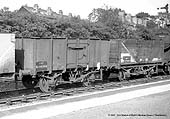
A BR 16 ton mineral wagon reconditioned after SNCF
service retaining continental style buffers at Water Orton |
 |

Ref:
mrwo1771
JS Doubleday
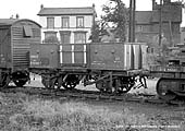
A British Railways built 13 ton Shock Open
Merchandise wagon, No B720128, seen at Water Orton circa 1959 |
 |

Ref:
mrwo1772
JS Doubleday
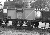
A BR 16 ton mineral wagon, No B59383, fitted with
top, side, end & bottom doors seen at Water Orton |
 |

Ref:
mrwo1773
JS Doubleday
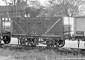
A BR 13 ton 7-plank ex-PO wagon, No P391288,
formerly Stephenson Clarke No 7576, is seen at Water Orton |
 |

Ref:
mrwo1774
JS Doubleday
A British Railways Bogie Bolster 'C', No B943423,
is seen loaded with timber at Water Orton circa 1959 |
Drawing of Plans and Elevations of Second Water Orton
Station
Ordnance Suvey Maps, Schematic Drawing and
Illustrations

|
